There’s a saying in exiled Uyghur photographer Ablikim Amat’s motherland: Without land, there is no life.
In the last decade, the vast politically contested region which its indigenous Uyghur inhabitants call East Turkestan, and which Chinese authorities call Xinjiang, or “new frontier,” has become known to the world as the site of a brazen genocide.
Under Chinese control, the Uyghur people and their way of life face an existential threat. But so, too, does the land itself.
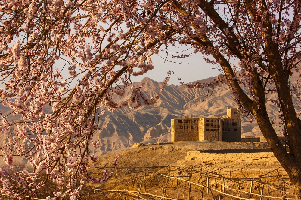
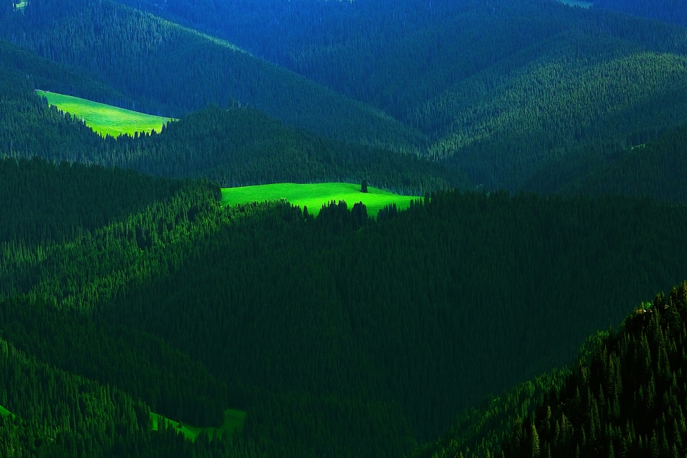
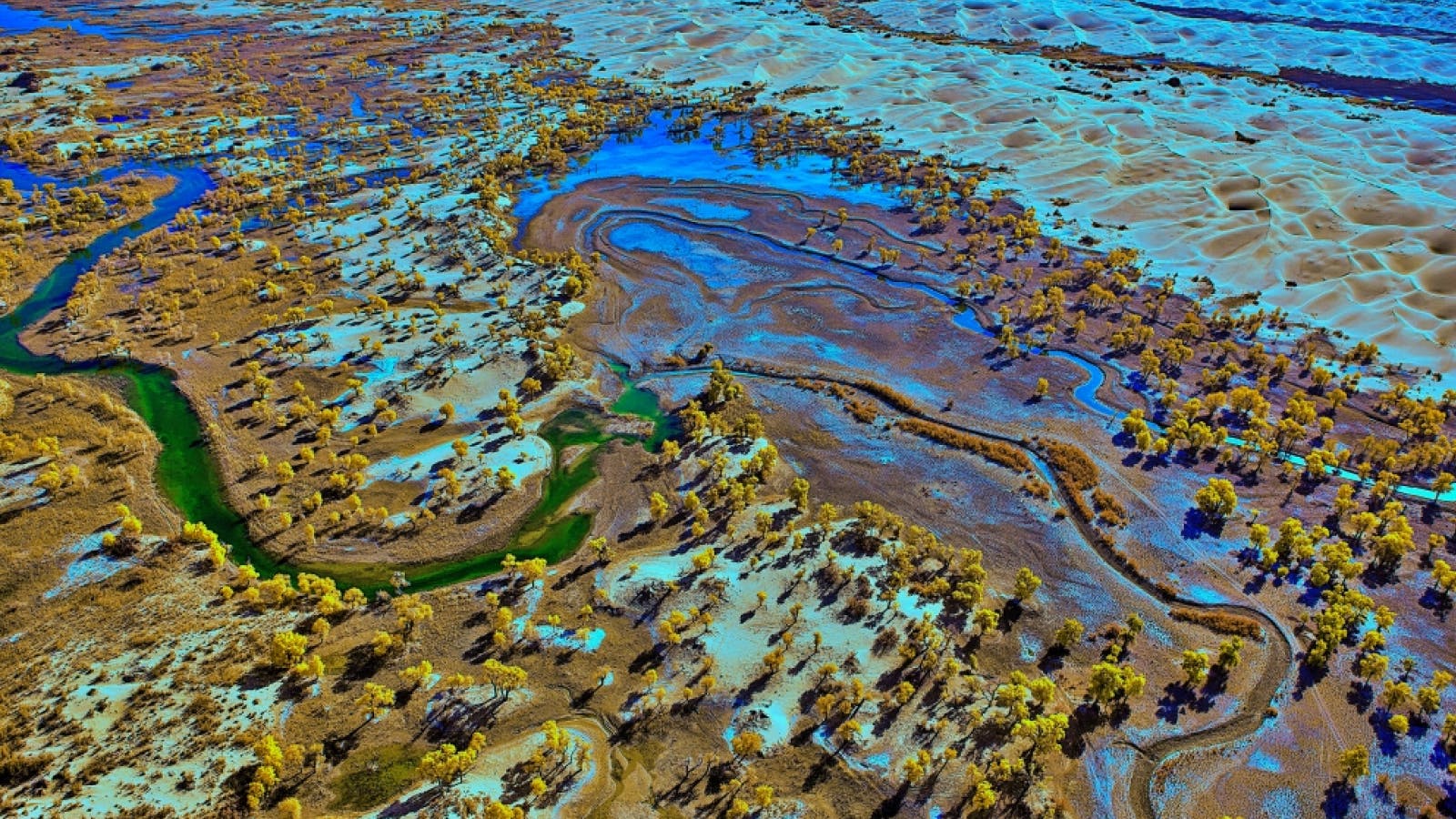
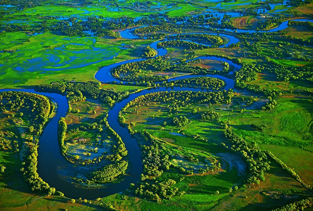
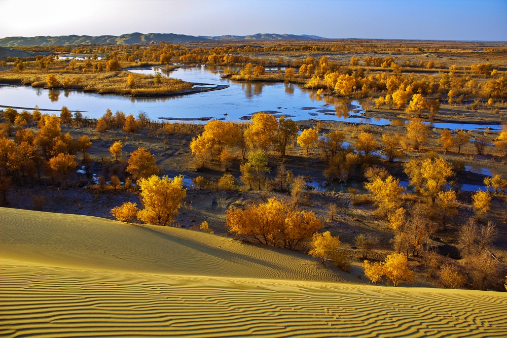
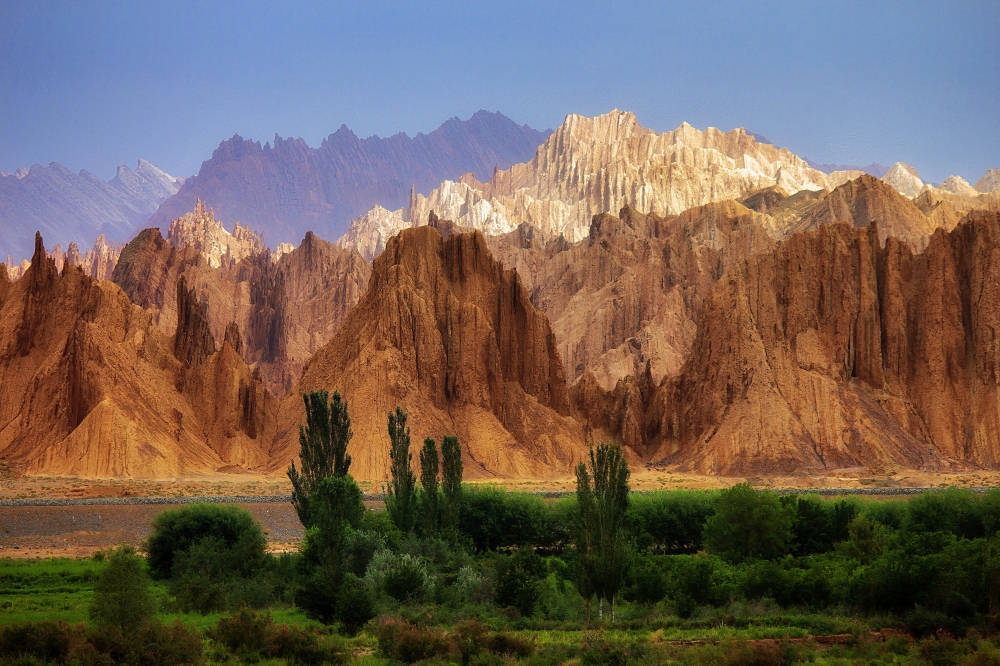
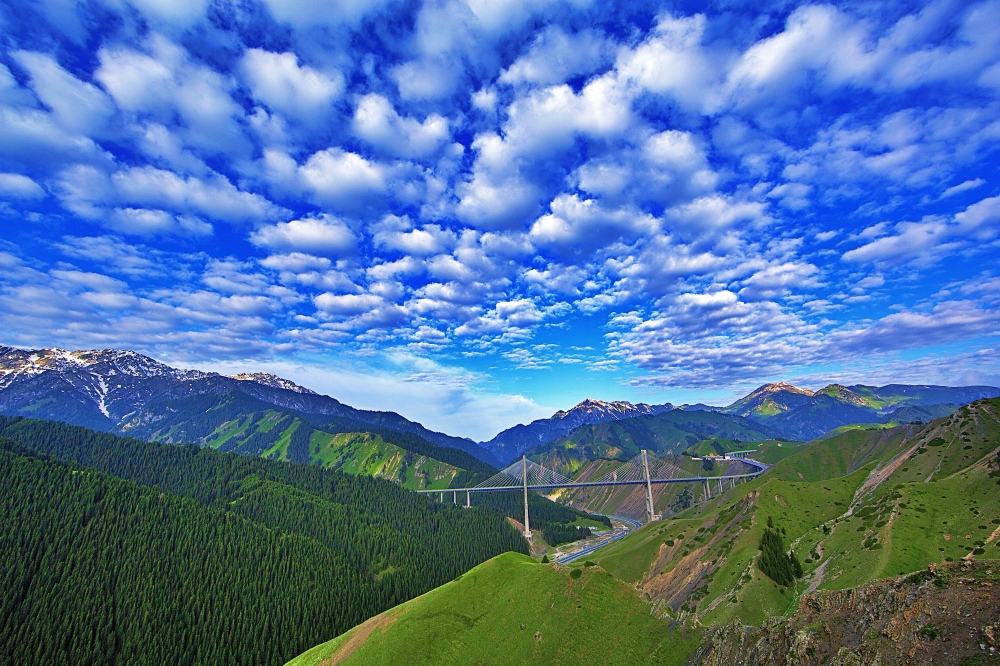
From 2000 to 2015, Amat traveled across the region to capture the desolate beauty of East Turkestan’s mountain peaks, oases, deserts and grasslands — landscapes which hang in the balance as Beijing works to extract the region’s abundant natural resources.
Researchers say Beijing’s exploitation of its so-called “new frontier” has depleted lakes and waterways, endangered plant biodiversity, and polluted the air. With the expansion of oil refineries, coal conversion plants, migration and development, and China’s multinational Belt and Road Initiative, the region’s local ecologies, public health, and access to clean air and water are all at risk.
“In recent years, my homeland and its people have become the target of unprecedented state-led oppression, and has gained the attention of the world,” says Amat, who now lives in Boston and is exhibiting his photography at the Harvard University Asia Center this spring.
For those with “a modicum of care and conscience,” he says, “I hope that through my photography, I can help you gain a clearer understanding of Uyghur homeland, its geography and its unique cultural heritage.”
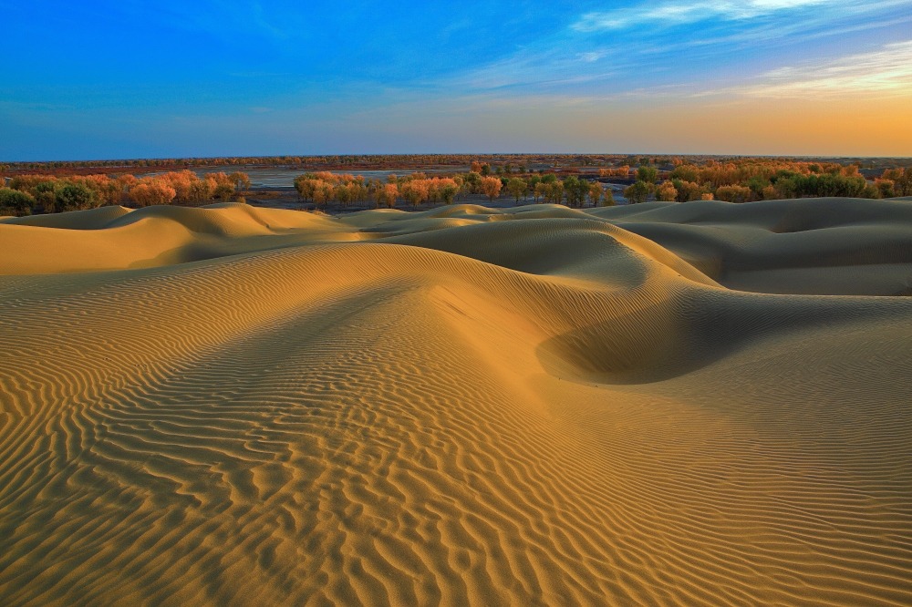
An award-winning photographer and calligrapher born in the Uyghur town of Khoshut, Amat dedicated himself to documenting his homeland’s haunting natural beauty before it’s too late. Amat worked from the ground and the air to capture East Turkestan’s unique geographical landscapes, from the lush Altai Mountains to the golden hills of the Tarim Basin to the Uyghurs’ unique irrigation system.
But under Chinese authorities, groundwater and glacial water reserves, among other natural resources, are being depleted. Longstanding sustainable agricultural and water preservation practices, based on indigenous inhabitants’ vast knowledge in adapting to the region’s harsh and dry climate, have been abandoned and dismantled.
China’s recent moves are part of a long legacy of imperial encroachment into Uyghur land. The race to extract and exploit the ecologically fragile land’s strategic geographic location and abundant resources — oil, cotton, coal, natural gas, gold, minerals, grains and medicinal plants — has led to centuries of Soviet, Russian and Chinese efforts to control East Turkestan.
“Xinjiang’s rich natural resources were a siren song attracting the attentions of foreign powers, Chinese planners, and provincial officials,” historian Judd Kinzley writes in his book Natural Resources and the New Frontier. “The campaigns to gain access to natural resources left a firm imprint, the outline of which remains visible on Xinjiang’s landscape.”
From mining to hydrofracking to unsustainable agricultural practices, Beijing’s resource extraction “aims to maximize profit at the expense of the environment, with little benefit or even consultation with indigenous Uyghur populations,” the Uyghur Human Rights Project’s 2016 report found.
Today, the South China Morning Post reports, the region’s Tarim Basin is China’s largest oil and gas-bearing area, with an estimated 16 billion ton of reserves. And, in an effort to decrease dependence on foreign oil and energy, the drilling continues.
Researchers say East Turkestan has been the site of ongoing settler colonialist programs, which in spurring migration, tourism and development are fueling a water crisis. It’s also the site of decades of nuclear weapons testing, which exposed over a million inhabitants to nuclear fallout and spurred environmental degradation including the drying of the Lop Nur lake.
That increasing desertification under Chinese water policies has in turn led to ecological loss, including the depletion of the poplar tree. Per the UHRP, official sources document that poplar forests were reduced by about 60% from the 1950s and to the 1970s.
As one researcher described in the report, “destruction of East Turkestan’s ecosystem destroys the Uyghur culture itself.” The poplar tree is iconic in the Uyghur culture. As Amat notes, there is a saying that Uyghurs sometimes tell their elders: Live as long as a poplar tree.
For both East Turkestan’s indigenous inhabitants and natural environment, human rights advocates fear the clock is ticking.